AE Project -Another Earth-
Project to create "Another Earth"
- We are creating a digital parallel Japan, a replica of real Japan using our unique technology.
- We have released marathon course in Sapporo which can be seen from any part of the world.
- We have showcased marathon course using a unique content – “Ultra-Wide-Angle video”(SuperWide3D)
- Please browse the course and enjoy the virtual marathon race course easily & quickly.
- We will continue adding more features & appreciate if you can share your ideas & opinions from here.
Tips to find location and height in the marathon course.
- Marathon course kilometer display
It’s calculated from the GNSS/GPS attached to the mobile mapping system (IMS: Dual Cam)
It’s based on the kilo mark post located at 11 different locations on the site and the space between them is calculated and displayed proportionally.
- About altitude (features will be added soon)
It’s calculated from the GNSS/GPS attached to the mobile mapping system (IMS: Dual Cam)
In addition, the peak point of the change in the gradient is calculated by the on-site actual measurement.
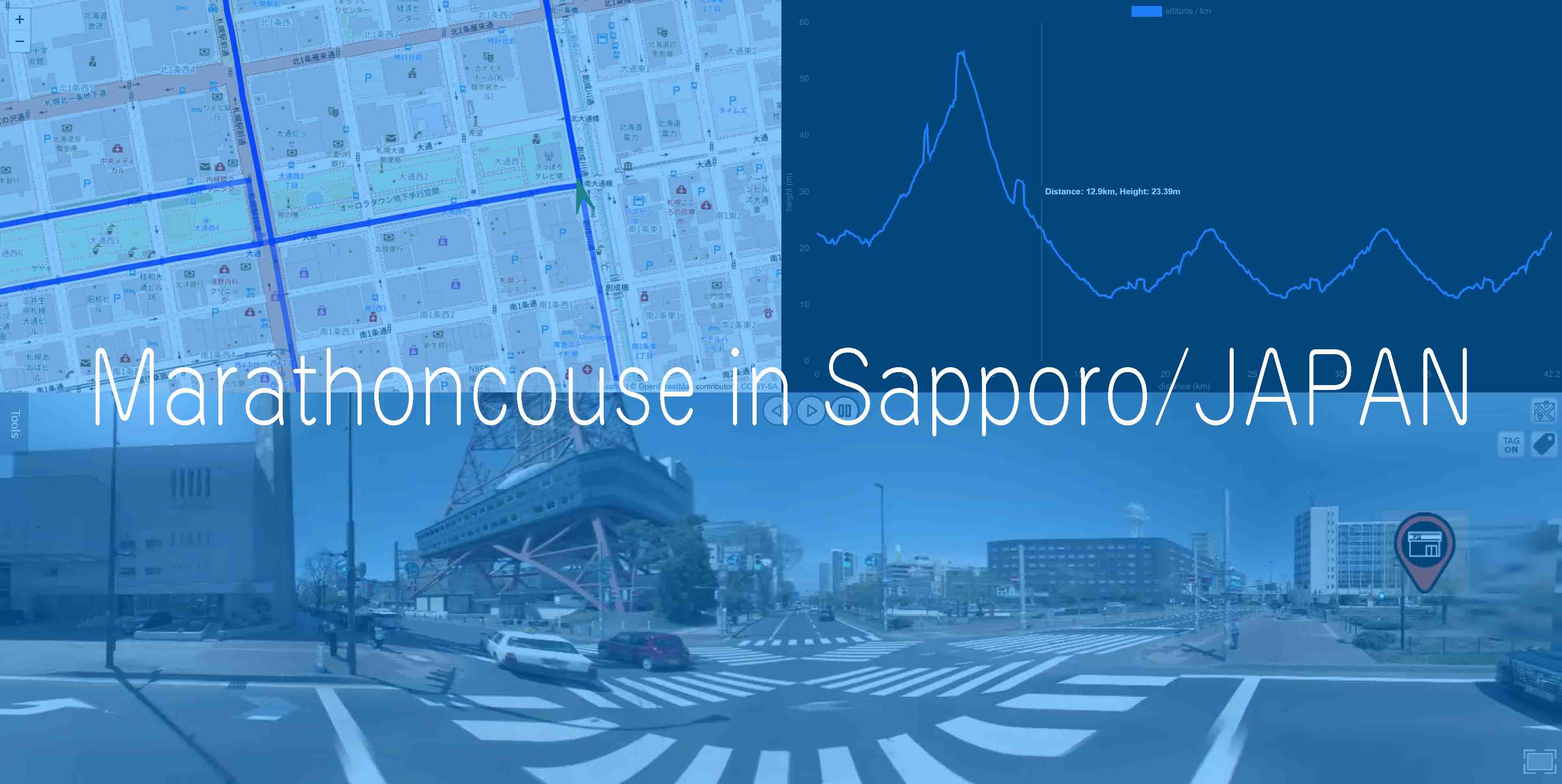
Marathon course in Sapporo/JAPAN
Recommended browser:
Google Chrome [version:92 or later]
Microsoft Edge [version:92 or later]
Please note that we haven’t verified it with all browsers.
At present, you may find hiccups with browsers like Safari, others.
We have not verified the operation on handheld or smartphones as well.
https://aepj.jp/marathon/index.html
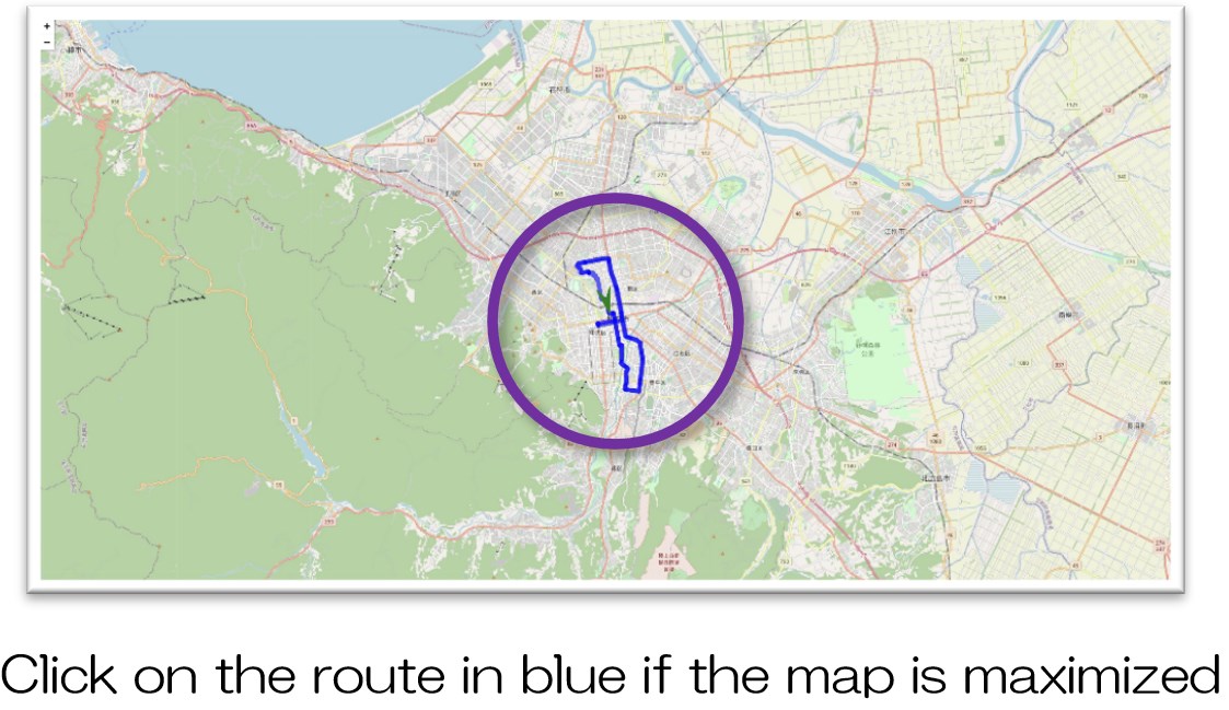
・Since this course includes laps, the running locus on the map shows the final lap of the lap.
・If there is a problem when the system,
you can restore it by clicking [Reload] on the browser → select the Trajectory(Blue line) on the map → Play button.
-
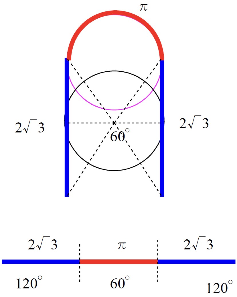
Regarding Super-Wide-Angle Image(SuperWide3D)
The SuperWide3D is an image that allows you to see the surroundings
with our original 300-degree ultra-wide-angle field of view.(Usually 180 degrees or less)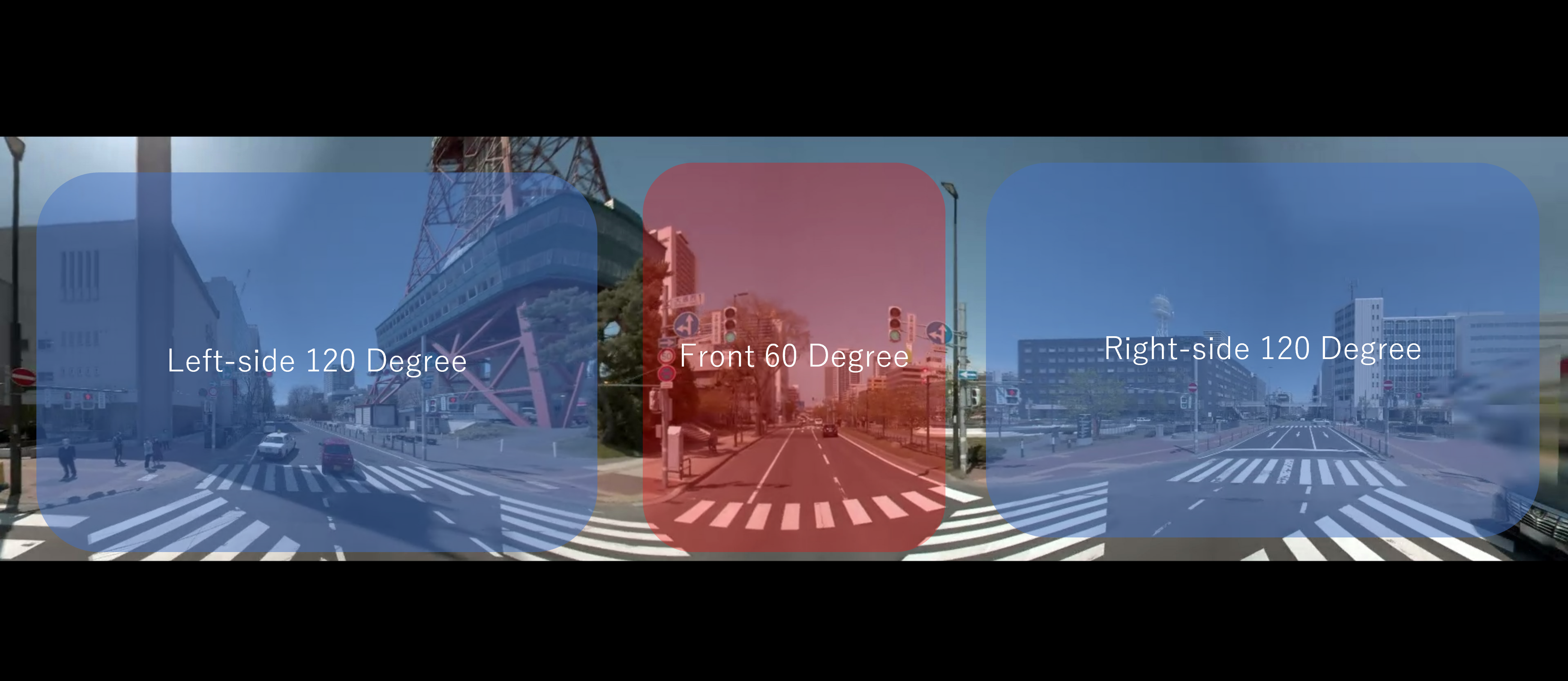
- Red line:Front-side / Blue line:each side
-
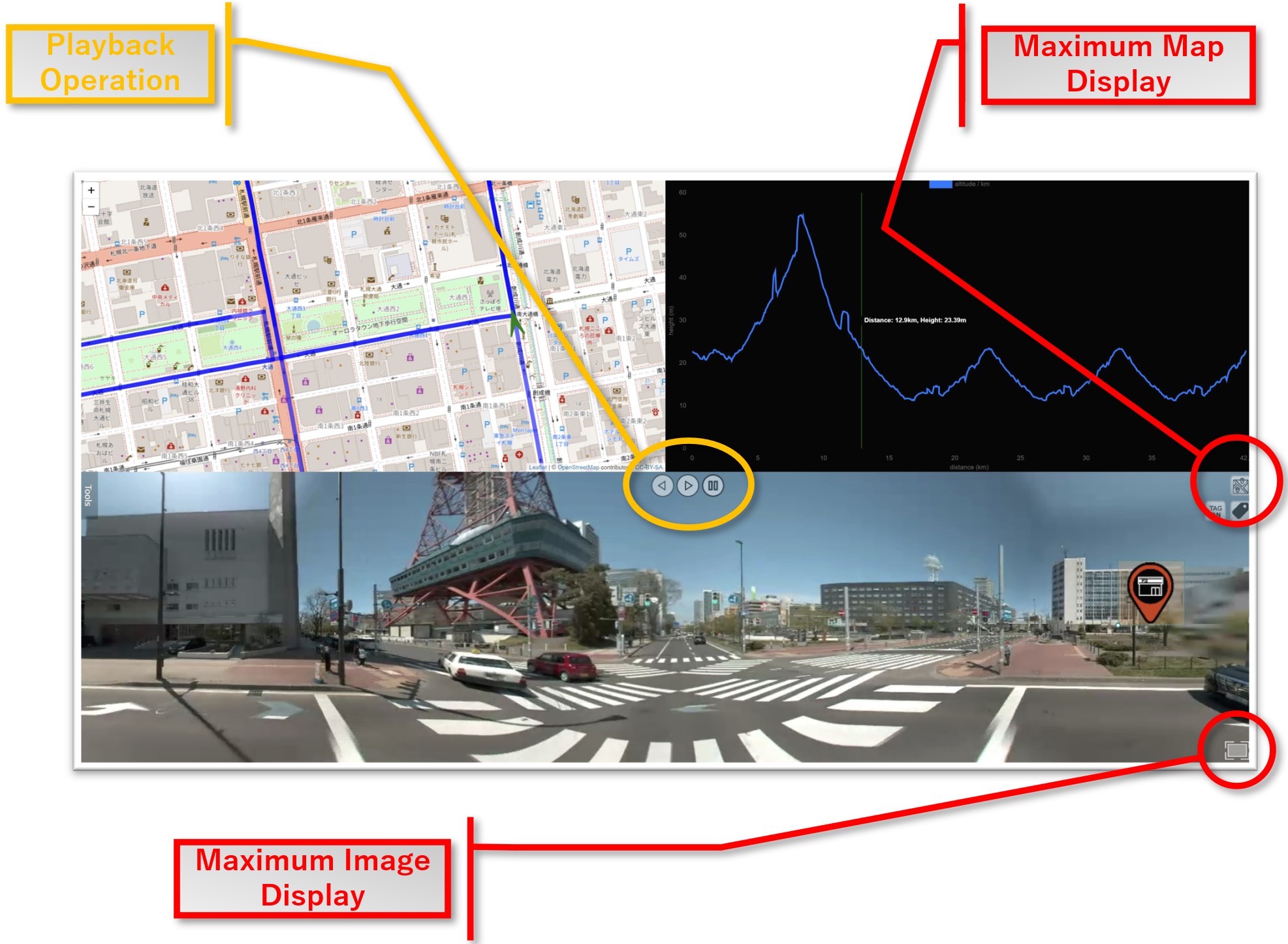
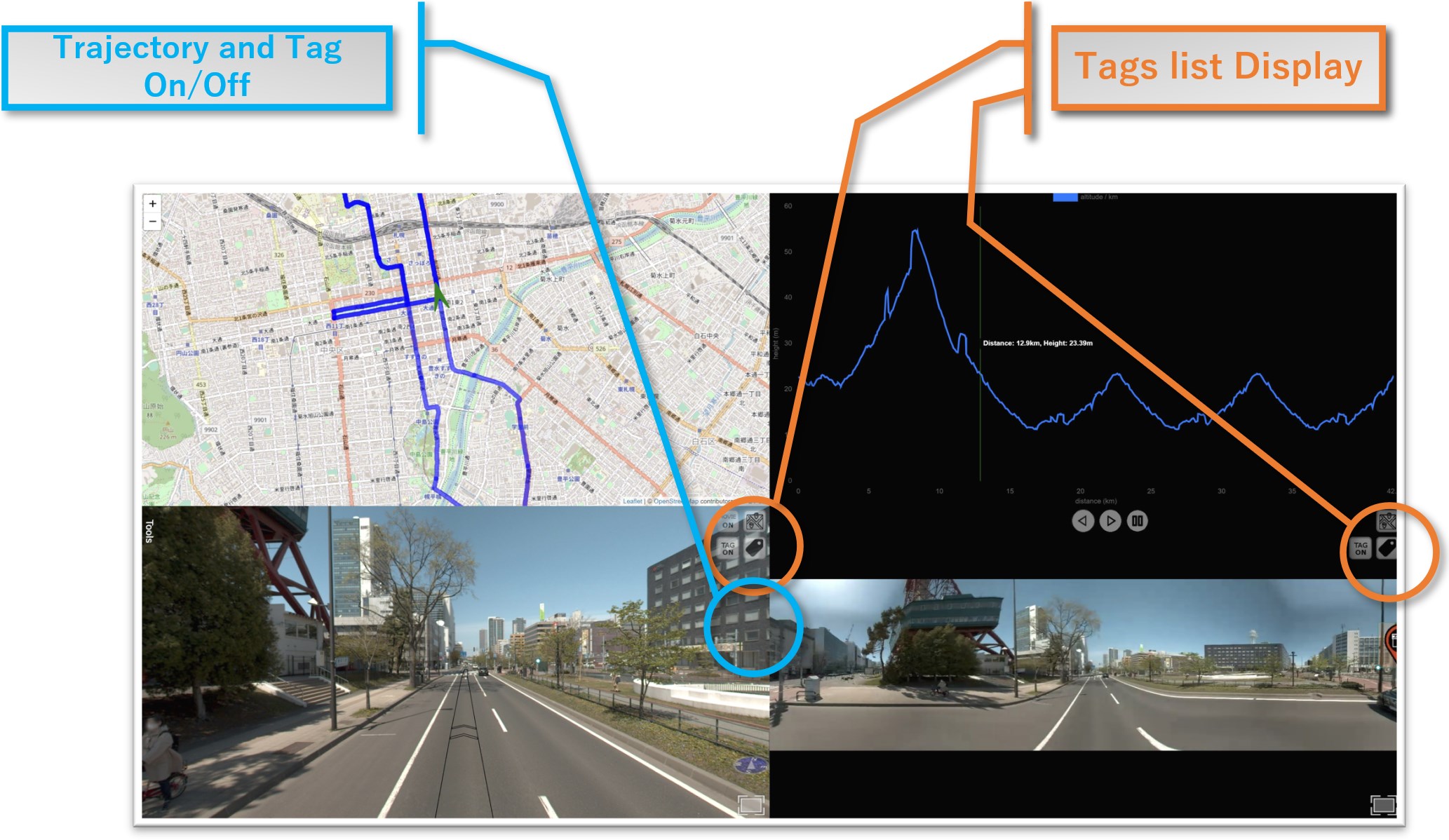
Main screen explanation
-
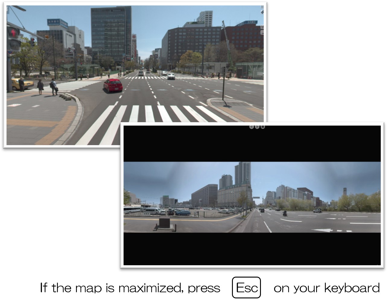
Maximize map display
- ・Check the map in a large display
- ・Use this feature to check the map contents in detail
-
Trajectory switching display
- Hide the video trajectory displayed on the road surface
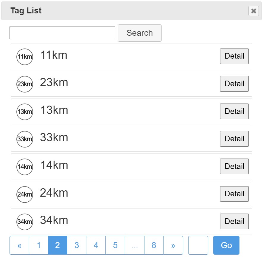
Tag-list switching display
Show the Tag-list then Jump as kilo marker
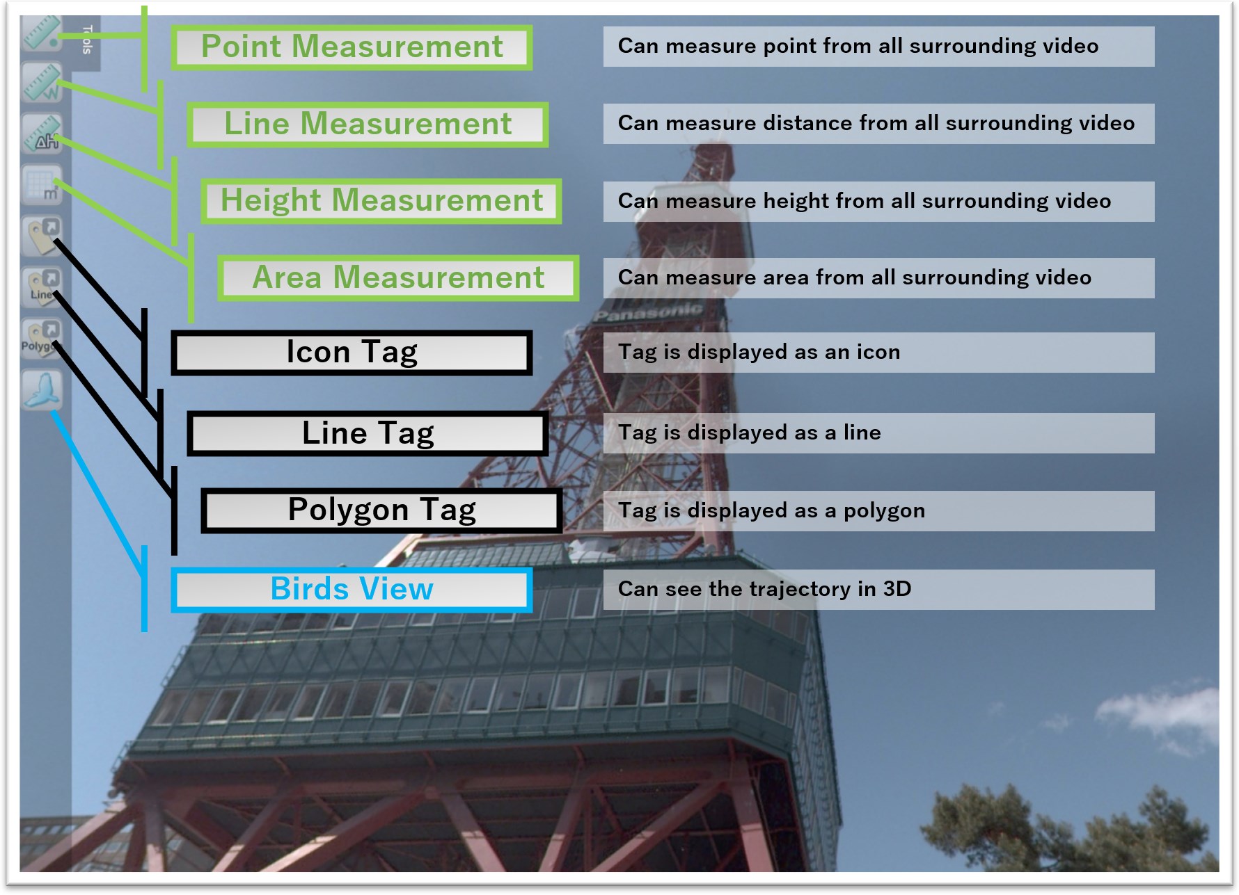 Tools
Tools- Various functions can be used
- You can see the detailed operation from pdf file.
-
 here
here - Disclaimer
・The Company shall not be liable for any dispute or damage caused by using the information posted on this service site.
・The Company shall not be liable for any damages caused to the user or a third party due to the content.
・Although we strive to keep the content on this website as accurate as possible, we do not guarantee the accuracy, completeness, reliability, or up-to-datedness of the posted content.
・We do not guarantee about the contents of this site and the information that users obtain through this site.
・We do not guarantee its accuracy, completeness, usefulness, up-to-datedness, appropriateness, certainty, operability, etc.
・To the extent permitted by applicable laws and regulations, this service and content will be provided "as is" without any guarantee.
・This site may be temporarily or for a long time can be down without any prior notice due to system failure or server maintenance.
・This site shall not be liable for any damage suffered by the user due to the temporary interruption or suspension of the provision of this service, etc.