


"Focus to achieve automatic recognition of space (robot eye) and
establish digital parallel world using advanced imaging techniques & solutions"
- News & Topics Headline -
| 30 Jan, 2025 |
【Company Introduction】【Technical Info】 CV video and CG synthesis video released.Check it from here.
|
| 30 Jan, 2025 |
【Company Introduction】【Technical Info】 We have released a video showing how utility poles and power lines are recognized and automatically generated. Check it from here. YouTube is here.
|
| 21 Jan, 2025 |
【Company Introduction】【AE Project】 "Another Earth" (Digital Twin) Trial website now open.
|
| 20 Jan, 2025 |
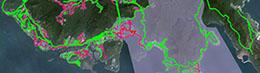
【Company Introduction】【AE Project】 The Noto Peninsula Digital Twin Site has been released.
|
| 11 Jan, 2024 |
【Company Introduction】【AE Project】 This movie is a company introduction of "IWANE Laboratories, Ltd.". One have detail,algorithm,case stadies and more information. As our company purpose, create of Another Earth(AE) Project introduction.
|
| 05 Aug, 2021 |
【AE Project】 Marathon course in Sapporo/JAPAN was added new function!! You can check Elevation during preview.
|
| 30 Jul, 2021 |
【AE Project】 Marathon course in Sapporo/JAPAN was open. The site where you can play a video of upon.
|
| 12 Jul, 2021 |
【AE Project】 A site where you can watch a video of the Sapporo/JAPAN marathon course will be released soon. |
| Sept, 2020 | GeoAI applied to Mobile Mapping Data to extarct GIS features like Street Light ,Traffic Light ,Traffic Sign ,Electric Pole , Manhole , Car , Motorbike , Bicycle , Human ( Pedestrian ) ,etc.. |
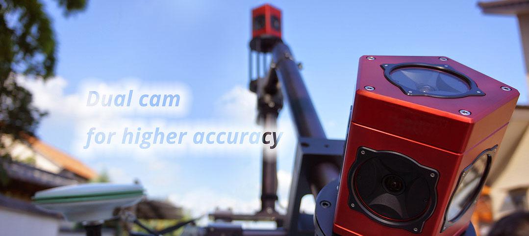
| March, 2020 | Developed & delivered New MMS (dual cam with laser) for Police, Japan |
| March, 2019 | Started Mapping for Nexco , Japan ( 20,000 Km ) and TNB, Malaysia selected Iwane Mobile Mapping for Utility Survey |
| Feb, 2019 | TNB, Malaysia selected Iwane Mobile Mapping for Utility Survey in Malaysia |
| 18 Dec, 2018 | IWANE Mobile Mapping System ( IMS3+ ) is being used to map 10 cities in Kingdom of Saudi Arabia and selected by local Municipality-MOMRA, KSA. |
| 16 Jun, 2018 | Iwane launched data processing services for small omni directional camera like Gopro fusion 360 and Garmin Virb 360. |
| 14 Jan, 2018 | IWANE Mobile Mapping System is used to map PLUS expressways in Malaysia covering 2,100 Km from top to bottom of Malaysia PLUS EXPRESSWAY This mapping is accomplished by our partners GeoInfo , Malaysia Check out for more details! |
| 16 Nov, 2017 | IWANE accomplished mapping of six office of NEXCO covering more than 3,500 Km of road network in Japan NEXCO The purpose of this mapping is to perfrom better planning on the ageging road infrastructure of Japan Check out the presentation video for more details! |
| 23 Mar, 2016 | IWANE is participating in the PIONEERS ASIA at Happo-en, Tokyo. Check out our Facebook for more details! |
| 5 Feb, 2016 | JETRO interviewed IWANE Laboratories: Iwane Laboratories was making pioneering steps in computer vision long before Silicon Valley |
| 11 Nov, 2015 | Exhibition : Geo Spatial Expo 2015 Iwane laboratories, Ltd. is going to participate in Geo spatial Expo2015 which is from November 25-28, 2015 at Miraikan (NATIONAL MUSEUM OF EMERGING SCIENCE AND INNOVATION) in Tokyo, Japan. Please visit us at our booth (#7) and we will be glad to introduce our products & technologies. |
| 9 Oct, 2015 | News : Tech Match in Bratislava, Slovakia Iwane laboratories, Ltd. is going to participate in TechMatch which is from Oct 12-16, 2015 in Bratislava, Slovakia. Please visit us at our booth and we will be glad to introduce our product & technologies. |
| 6 Oct, 2015 | Driverless car & advanced navigation Check out our new movie of Driverless car & advanced navigation on Youtube! |
| 1 Sep, 2015 | News : Iwane is participating in TechCrunch Disrupt 2015, San Francisco, SEP21-23 Iwane laboratories, Ltd. is going to participate in Tech Crunch ( Disrupt SF 2015, September 21 - 23, 2015 | Pier 70, San Francisco, CA). Please visit us at our booth and we will be glad to introduce our product & technologies. Read more... |
| 21 July, 2015 | News : Iwane participated in Vietnam Transport & Logistics Conference & Exhibition , Vietnam Iwane Laboratories, Ltd. along with Oriental Consultants Global participated in Vietnam Transport & Logistics Conference & Exhibition organized by Ministry of Transport (MOT) of Vietnam held on July. 08-10, 2015. Read more... |
| 12 May, 2015 | News :Iwane IMS3 Mapping Taiwan Roads IMS3 Mobile Mapping System from Iwane is used to map territories like New Taipei City, Hsinchu County and Provincial Highway of Directorate General of Highways, MOTC, Taiwan. Read more... |
| 13 March, 2015 | News :Iwane IMS3 Mapping Russian Roads IMS3 Mobile Mapping System is used to map federal roads (M60 USSURI & M58 AMUR) and Chita City municipality roads in Russia . Read more... |
| 03 Febuary, 2015 | News : Iwane participated in ESRI APUC at Hong Kong Iwane Laboratories, Ltd. along with Esri China (Hong Kong) participated in 10th Esri Asia Pacific User Conference held on Jan. 27-28 , 2015. |
| 08 December, 2014 | News : Iwane participated in Geoinfortech2014 at Bangkok, Thailand Iwane Laboratories, Ltd. along with Motorway Department of Thailand participated in Geoinfotech2014 exhibition & conference held on Nov. 12-14, 2014. |
| 04 November, 2014 | INVITATION : Visit us at the G SPACE EXHIBITION Visit us at the G SPACE which is due to take place from 13th to 16th November this year in Tokyo, Japan! |
| 18 January, 2014 | Won tender in Thailand February, 2014 - Won another tender in Thailand for “ Supply of MMS system for mapping all roads in Thailand Territory” |
| 20 March, 2013 | Won tender in Hong Kong March, 2013: - Won service based tender in Hong Kong for the “Acquisition of road inventory using MMS technology for Hong Kong” |
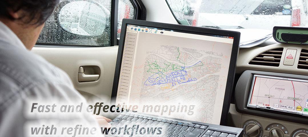
Iwane provides turnkey Mobile Mapping Services around the world which includes straight from MMS mobilization, Data acquisition, post-production....

Another Earth" Digital Twin

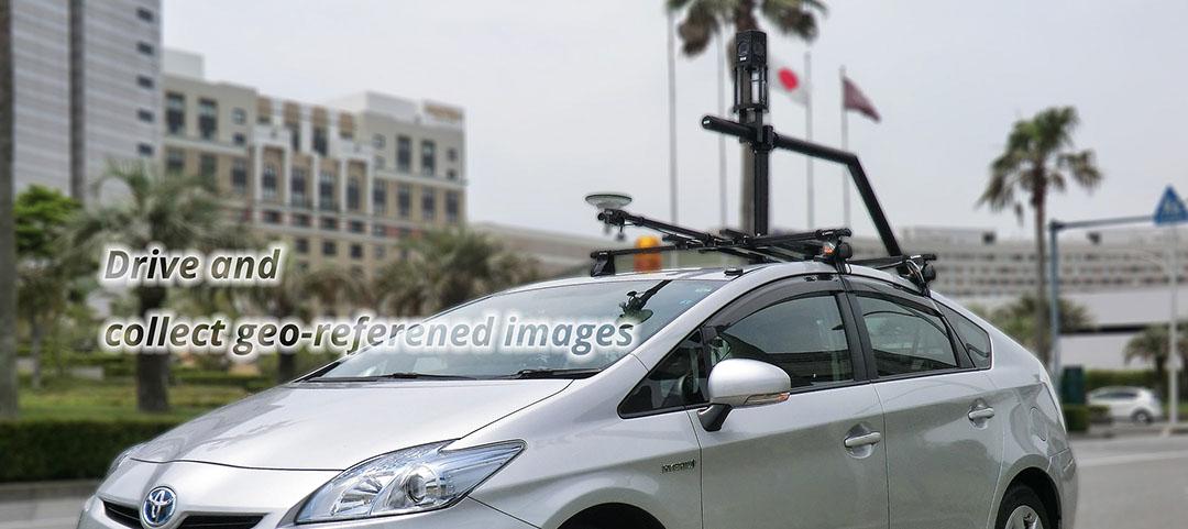
MMS : Iwane Mobile Mapping System

Digital Twin of the Noto Peninsula Earthquake Area

Creating AnotherEarth
Automatic Recognition of Traffic Signs
Automatic Recognition of Utility Poles
MOBILE MAPPING SYSTEMS
OUTDOOR
INDOOR
AERIAL
ALV SOFTWARE SERIES