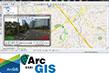
Map on 3D
For automatic road marking extraction and populate 3D Digital Map

https://www.iwane.com/eng/products/mapon3d#sigProId8ffd605d51
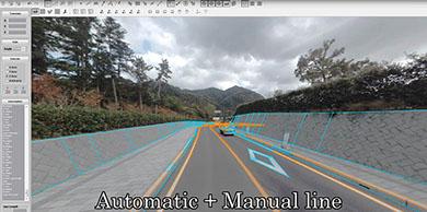
Map on 3D is a high accurate automatic 3D map (road marking) making application based on MMS data of IMS3. Map on 3D can detect three-dimensional shape of the white lines and extract more than 70 % automatically.
Design Concept of Map on 3D
■ To create highly accurate three-dimensional map and the high accurate road map using ortho-rectification.
■ The road surface selection processing is automated whereas other areas can be extracted using 3DPCCI (3D model can be created from CV image) in a semi automated process.
■ Accuracy of extraction depends on the road surface conditions. Related to our accuracy results , we have evaluated relative accuracy in terms of captured data on the road with 4 lanes.
■ Relative accuracy from the data having 4 lanes (± 3 to 4cm)
■ Total accuracy < Relative accuracy (±3cm) + Absolute accuracy (± 2 to 5cm)
■ During post-processing, the coordinates can be integrated.
■ The complete spherical (360degree) image without any dead angle can be used by the GIS industry besides the Surveying.
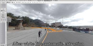
Data processing method -White lines Detection
In the first step, extraction of the white lines (road markings) is performed on each 1 m in length. The white lines consist of group of 3D shape and rectangular in form.
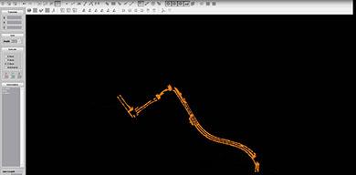
Then integration of GPS/GPS+ IMU data, align white lines, and making continuous white line are performed while making ortho map in Map on 3D . We can align , edit & complete shape and convert these small line data to one complete white line using 3D vector digitization tool.
Measurement accuracy
The combination of frames is sufficient enough to estimate that 3D error (relative accuracy) is around 1-2 cm (our assumption) on the white line with a width of 15 cm.
It is possible to process CV image of streets having 4 lanes with high accuracy. If the accuracy is not sufficient in case there are more lanes, we can use 3D coordinate integration.
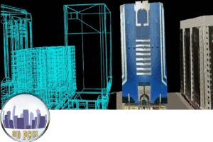
Going ahead, we are also working on Automatic 3D Map using which can recognize other features/ objects on the streets like curb, manhole, catch pit, pavement side, ground boundary, signal, signboard, and building shape, etc.