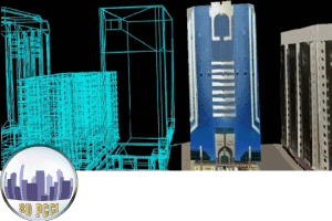
3D PCCI
for 3D Building Model development

https://www.iwane.com/eng/products/threedpcci#sigProIdc98ee9e921
3D PCCI (Programmable Continuous Combined Image)
Making photo realistic 3D models using IMS3 MMS
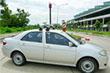
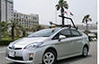
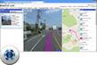
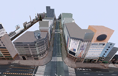
In order to create 3D City Model along with landscape (which may consist of many objects like buildings and terrain), one have to use Iwane application modeling software -3D PCCI. In order to achieve this, we need to capture Omni directional street level imagery first by driving through the street network using our image data acquisition hardware (IMS2/IMS3).
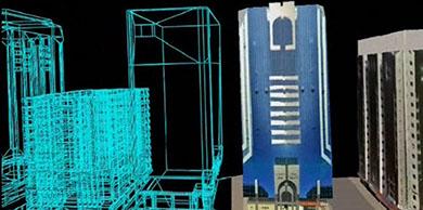
After the data acquisition, we have to perform data processing in which image processing is performed and derive camera position & posture in the relative environment using the sequence of imageries. This helps to integrate each 3D Coordinates with different image data. After that we have to digitize the polygons manually and extract texture automatically to build 3D CG models.
Due to the restricted field of view of camera sensor , the roof top of the buildings cannot be captured while terrestrial data acquisition . In order to complement this missing portion , we provide a flexibility to use aerial or satellite images and paste on the roof polygon.
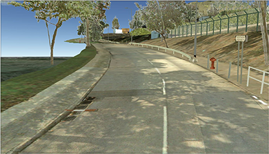
The quality of the 3D Models look very realistic because it is made of photo realistic texture captured during the data acquisition phase. We can also make Computer Graphics (CGs), which seem real by using the texture from the CV image of the real world.
We also provide a flexibility to update a part of texture or use higher resolution texture in 3D polygon. For this, user can capture picture of area of interest by digital camera and paste on the portion which needs to be changed.
By integrating the coordinates of the CV data calculated from the road level and aerial video of the same area, it becomes possible to treat the polygon corresponding to the each video as the same object is in the same coordinate system and the texture can be extracted from both of them.
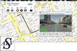
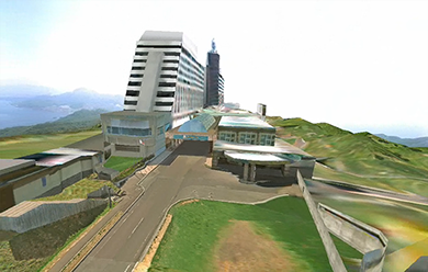
You can see the 3D PCCI model of the Windsor hotel Toya, the venue of G8 Summit 2008, made from the road level video and the aerial video in the demo movie.
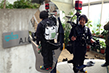
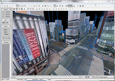
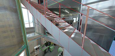
Apart from outdoor modeling, indoor modeling is also possible using iwane MMS systems. The data can be collected by mounting system on the small cart or backpack. After post processing, w can use 3D PCCI tool to extract photo realistic 3D models of indoo with and without location. The available output format of the 3D model are Advanced City Engine (ESRI) , Vrml , Dae , Collada , Kml , etc..
Key Features
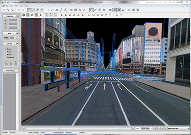
■ The polygon and the texture can be acquired at the same time from the images directly by using our CV Technology.
■ User can obtain three-dimensional coordinates directly from the image by clicking a point on the image.
■ The detailed polygon and the textures are generated from all surrounding video image captured not only from street level imagery but also aerial imagery.
■ The matching between the polygon and the texture is perfect and the coordinate’s accuracy and the reality of 3D CG are substantially upgraded.
■ All the image sequences captured in the video can be developed as 3D CG, and the images which have not been captured in the video can also be developed as 3D CG through the coordinates integration technology with other imageries and the aerial video, which can be treated like the same image sequences.
2D PCCI
Two dimensional programmable combined continuous images can be extracted from post processed MMS content. In this infinite long continuous strips of image can be generated automatically using the application software tool. This is a unique content and can be possible by CV technology and can be used as a line sensor image with high accuracy.
Some of the examples of 2D PCCI are given below.
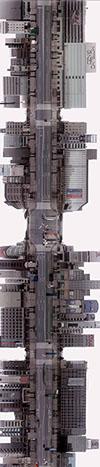
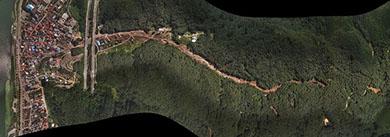
Aerial Flat View PCCI
2D PCCI
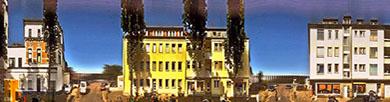
Façade PCCI
Aerial PCCI
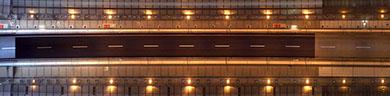
Tunnel PCCI
DOWNLOAD
Demo: 3D PCCI "Taowan" on Google Earth![]()
■ Scroll Wheel: Zoom IN / Out
■ Left Mouse Click + Drag: Move
■ Shift + Left Mouse Click + Drag: Tilt
■ Ctrl + Left Mouse Click + Drag: Look around
■ Right Mouse Click + Drag: Zoom and Automatic Tilt
■ >> Go to Google Earth Help site
**Please install >> ![]() and click here to start.
and click here to start.
![]()
Demo: 3DPCCI on VRML Viewer![]()
■ 3D PCCI " In an Office" on the VRML
■ 3D PCCI "San Diego" on the VRML
**Please install (by Manual Setup) >> ![]()